Articles

A DAY AT THE AIRSHOW

In Uncategorized on June 16, 2015 by John Hochheimer

WOW! It is hard to believe that a year has passed since I was spending my days on the saddle of a bike. Today I am at the Paris Airshow on the beautiful LeBourget Airfield. This day brings warm sun, blue skies, and a cooling breeze to make it nearly perfect.  Why am I here, you may be wondering? I am here for this:


But more importantly, I am here to help run the annual International Rocketry Competition, in which winning teams of students from national rocketry competitions fly their rockets and present their experiences for the chance to become the 2015 International Rocketry Competition champions.  Tomorrow seven students from Russellville AL will arrive at the Charles de Gaulle airport ready to take on the world.  Our awesome sponser, Raytheon, and in conjunction with the Aerospace Industries Association, provide us with the resources to support this great event for the U.S. team. This is my fifth international airshow (had to miss last year’s event because I was pedaling across the northern tier of our great country).    Ok, I am rambling…

So I am sitting here in the sunshine passing time by looking at many people as they mill around the airshow; these people are looking at the displays, learning new things, and most importantly doing the necessary business of keeping our commercial and defense aircraft and space system industries thriving.  I wait and plan for the next three days of events for our U.S. student delegation (Christian, Niles, Andrew, Katie, Evan, Emma, and Chelsea). Wednesday, they will arrive; wide eyed and a bit tired I am sure.  Lunch in Paris to start them out. 

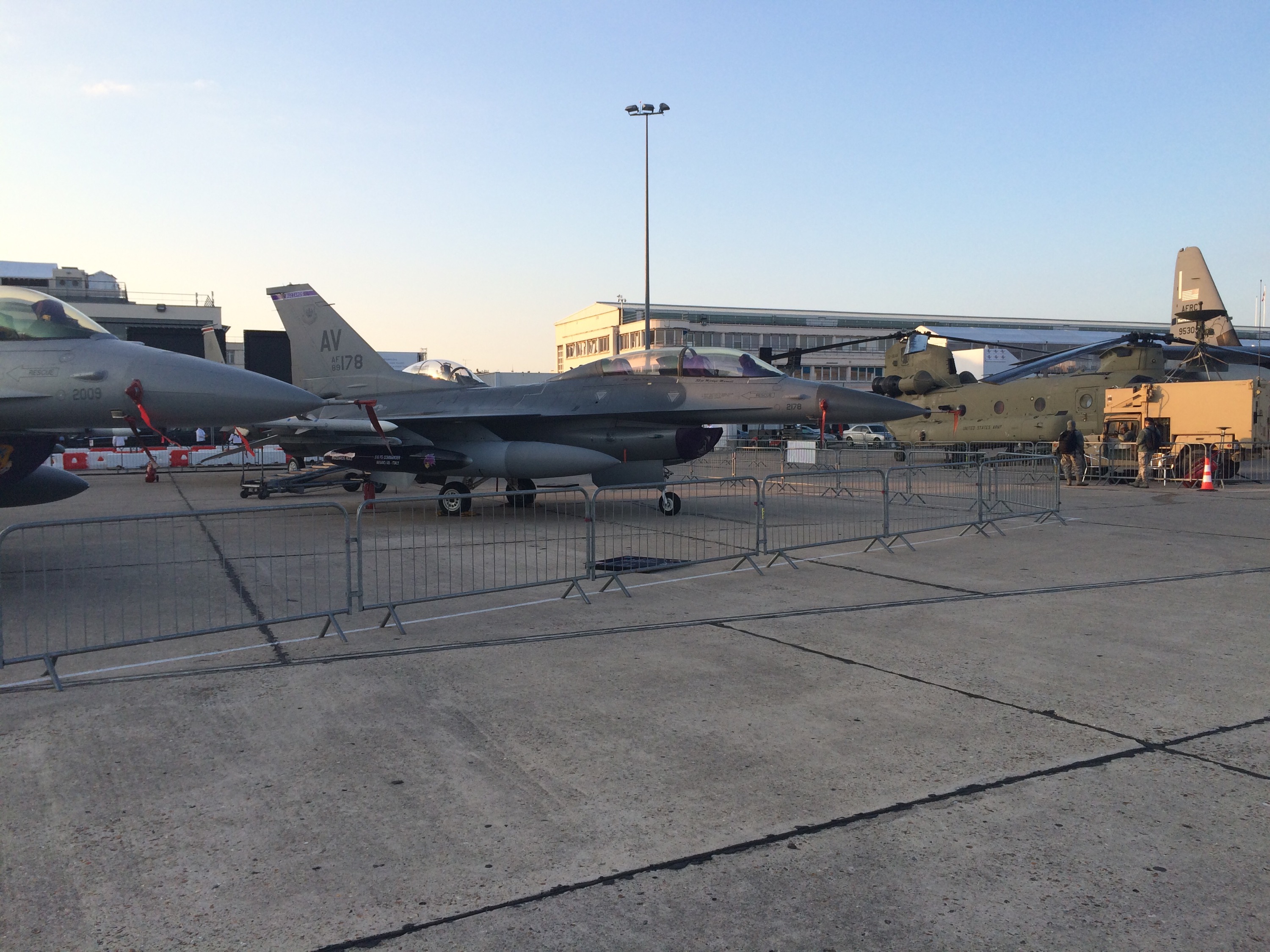
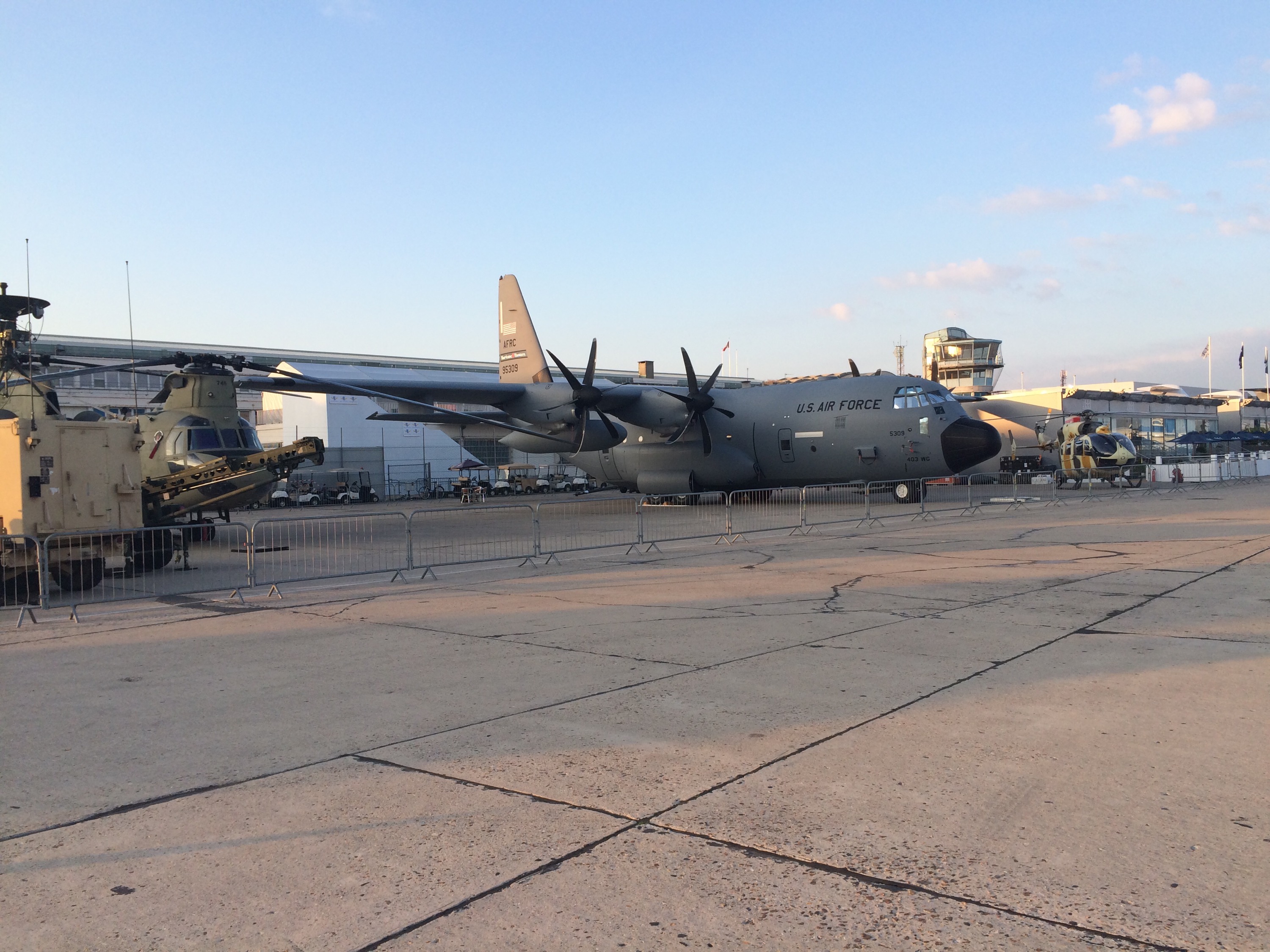
Hopefully they will get to relax some in the afternoon and evening because Thursday is presentation day. Up early and into the van for the short in distance (yet long at times for the duration). Meeting with groups at the airshow, some lunch and then we are into the competition. The presentation lasts 20 minutes. My guess is that it will be about 20 hours they prepared for this 20 minutes; maybe more. Thursday evening is dinner with the crews of the magnificant equipment shown in the photos.  Hopefully some sleep because Friday it is up early again for the flights of the students’ rockets front and center at the airshow. Another early morning in the van to the show, prepping the rockets for flight, thru some intense security, and onto the airfield for the contest.  Plans are for the students to meet some important people just before we set up for the countdown to their destiny in the contest.  We are hoping for 0 points and an unbroken egg; time will tell.

Articles

Day 60 The journey is finished

In Uncategorized on July 13, 2014 by John Hochheimer

Thursday July 10

Start: Waldport, OR
Destination: Heceta Lighthouse
Day total miles: 24
Journey final miles: 3834

Towns passed through
Waldport, OR

Done. More thoughts to come.

Articles

Day 59. Part 1

In Uncategorized on July 9, 2014 by John Hochheimer

Wednesday July 9

Start: Beaver, OR

Loving life. Ocean to my right. North winds at my back. Heading south. Tomorrow the lighthouse in Florence.

20140709-090630-32790071.jpg

Articles

Day 57 Rest in Portland

In Uncategorized on July 8, 2014 by John Hochheimer

Monday July 7

Resting in Portland.

Articles

Day 55 I can’t believe the squirrel ran between my wheels

In Uncategorized on July 5, 2014 by John Hochheimer

Saturday July 5

Start: Maryhill State Park
End: Cascade Locks
Day total miles: 69
Journey total miles: 3595

Towns passed through:
Biggs, OR
The Dalles, OR
Rowena, OR
Mosier, OR
Hood River, OR
Cascade Locks, OR

THe days ride starts early to beat the heat and traffic. Slept through the fireworks from the previous night; rumored to be the best in quite a while in The Dalles. Darkness came too late for me to stay up and watch. Besides, if i could not be at Great Meadow to watch the fireworks, i would have to forego them for a year.

20140712-120216-43336480.jpg

20140712-115857-43137680.jpg

Crossed the bridge to leave Washington for the last time and enter Oregon to be in the final state for the remainder of the trip. Over the bridge advertising strong cross winds – there were none. The ride then takes me along a frontage road, then onto the interstate. No real traffic to speak of; guess all of the late night activities for the 4th had people sleeping in. Ok by me. Off of the interstate and then following a path through The Dalles to the Columbia Gorge Discovery Center and then onto Rt 30. Looking at the map and the elevation profile, i am thinking that looks like an impressive climb. Roll into Rowena and have to decide – take the prescribed route or the interstate to avoid the climb. Glad I decided on the climb. Up the hill I go, onto a winding, switchback road. Lots of bikes are there some passing me from both directions. The views are spectacular.

20140712-120404-43444264.jpg

20140712-120404-43444711.jpg

20140712-120404-43444926.jpg

Once at the top, there is an overlook to complete the climb. So glad i made the decision to climb instead of take the interstate.

The downhill ride was fun and it took me past several orchards and into Mosier. The first store i come to is an ice cream shop, Have to fill up and cool down. Besides, this diet will soon come to an end and it will be back to a much more limited and conservative diet. Yum, strawberry.

After Mosier, continue on to the Historic Columbia River Highway Trail. Another fun and scenic trail through the woods. Many more bikes and walkers to deal with, but all were courteous.

This is where the squirrel incident occurs. As I am pedaling along, I see a grey blur from the left. Then, it is literally underneath me as it ran between the front and rear wheels of my bike. Lucky for both of us that it made it through, as I am sure it would not have been pretty for either of us.

As the trail ended, and I approached EK, was thinking that he is running behind. So, the curse of a flat tire finally hits him too. I told him about the nice ride he had ahead and of course the ice cream. He let me know where the car was parked and that the interstate was not too bad after Hood River. Not too bad was relevant. Maybe his side was better.

Hood River seemed to be full of wind surfers and shops supporting them. Some hills to also navigate. Then it was off to the interstate for about 15 miles. Most of the time, it was a good, easy ride. But one curve had little shoulder and was a bit scary. Was able to successfully navigate the scary part to then get off and take a side road for the rest of my journey of the day. Cascade Locks seemed to be a sleepy little town. With the heat building, was glad to be finished for the day.

Articles

Day 54 All I can say is thanks for the store in the middle and the downhill at the end

In Uncategorized on July 5, 2014 by John Hochheimer

Friday July 4

Start: Umatilla, OR
Destination: Biggs, OR
Day total miles: 76
Journey total miles: 3506

Towns passed through:
Umatilla, OR
North Rosevelt, WA
Maryhill State Park, WA

Oh no, back in Washington.

20140705-173609-63369661.jpg

But the sunrise over McNary dam was pretty cool

20140705-173717-63437101.jpg

THe warning sign just outside of Umatilla should have read “No services for 83 miles AND pretty boring road.” The ride down WA 14 started out with a few large farms. The orchards were huge. One had trees that were held up on trellises forming a tunnel between the rows. And there was a large field that had fabric covering the field. Not sure how to best describe it. The width looked to be about 500 ft and the covering ran length wise for as far as I could see. Then the fields turned brown and nothing around. Mile after mile of rolling hills. Slight winds, not as bad as yesterday.

The oasis was found in Roosevelt. A small campground featuring a restaurant and store. Needed a break. Once again, the pancake was bigger than the plate. Good food. Overheard a lesson in “may v. can” given to a young customer. Signed the book for bikers passing through and talked to a local farmer turned trucker. He had farmed 2500 acre of cherries among other things. That is a lot of cherries. We talked about harvesting – via shakers for the cherries. Also, the apples on trellises were fuji apples. Oh and the fabric covered fields were blueberries.

And I pedaled along. Did spot a good photo op:

20140705-175418-64458658.jpg

Still pedaling. Ok. let’s talk about why there is a need for rest stops along the roads. Never really gave it too much thought until i stopped counting discarded bottles of urine along WA Rt 14. Should be named “Pee bottle highway.” In Montana, there rest stops (quite impressive ones) out in the middle of nowhere. And I guess for good reason. WA should take note. BTW I counted 387 bottles ranging from small water bottles to gallon jugs. I am speechless.

The good part of the ride was, after a big climb, a great downhill run to the finish at Maryhill State Park. Just on the other side of the river from Biggs.

Articles

Day 53 You can’t argue with physics and geography

In Uncategorized on July 5, 2014 by John Hochheimer

Thursday July 3

Start: Waitsburg, WA
End: Umatilla, OR
Day total miles: 76
Journey total miles: 3421

Towns passed through:
Waitsburg, WA
Walla Walla, WA
College Place, WA
Lowden, WA
Touchet, WA
McNary, OR
Umatilla, OR

Last state:

20140705-164257-60177604.jpg

This was a tough ride. The winds picked up and pushed me back the entire journey. The variation in scenery made up for the hard riding conditions.

Started out of Waitsburg toward Walla Walla and was impressed by the huge wheat and pea fields.

20140705-164759-60479096.jpg
That is wheat on the left and peas on the right. Not sure about why they are letting the peas dry out, maybe seed? Then on to Walla Walla. The town was ok, if you see one medium sized town, you have seen many. Car dealers, shops, different neighborhoods. Not really much that I could see as unique along the route I took. Then riding out of town, the smell of onions permeated. There was a large field on the left being harvested, by hand. That sure was a lot of onions. I think Walla Walla onions are the Vidalia of the west (am sure that could get someone talking). Then passed a few wineries, must be getting into wine country. This one was impressive from the outside:

20140705-165347-60827446.jpg

Kept riding along, until my allergies kicked in big time. What was that sweet flowery smell? Looked over and there was this huge field of purple flowers.

20140705-165610-60970729.jpg

20140705-165610-60970535.jpg
Yes, as far as I could see there was a field of lavender. I have certainly seen the variety of US agriculture.

Just when I thought the wind was annoying enough, I approached water and steep canyon like walls. The Columbia River Gorge was near and the physical features of the gorge and wind helped to make the gusts that much more annoying. The garmin said i was going down hill, but the pedaling was not agreeing. Settled in for a long slow journey to Umatilla. In the heat and wind. I guess the gorge and beauty of the surroundings helped, but it was a toss-up.

Ended in Umatilla, an old and now defunct army depot for storing chemical weapons. Lucky them. The depot has been closed down and all of the stored chemicals incinerated. Long day that ended in a dreary spot.

Articles

Day 52 Not sure which is more challenging

In Uncategorized on July 3, 2014 by John Hochheimer

Wednesday July 2

Start: Lewiston, ID
End: Waitsburg, WA
Day total miles: 80
Journey total miles: 3345

Towns passed through:
Lewiston, ID
Clarkston, WA
Pomeroy, WA
Delaney, WA
Dayton, WA
Waitsburg, WA

It does not seem fair when the uphill is 9 miles and the down only 2. Had two long uphill climbs today and it seemed like, well ok at 7 mph it was more than an hour climbing up each. The day started early with a ride along the river in Lewiston. Tried to beat the heat that was expected to reach mid 90s. It did. Through Lewiston and then immediately into Clarkston and Washington. Only one more state to go.

20140705-162132-58892961.jpg

After clearing Clarkston, there were road crews setting up for some kind of major project that involved a pilot vehicle and lane closures. The construction was not going when i rode through, but the shuttling of cars behind the pilot vehicle was. I kind of liked the fact that this was going on because it meant that the cars and trucks passing me were in bunches.

After about 10 miles began the first big climb of the day. Oh, and the local people we talked to all agreed that there would be quite the climb — 2000 ft in 9 miles that was a lot of turns and looking up.

20140705-162627-59187720.jpg

After the first climb, it got hot. And frankly, not too interesting. Just lots of dry fields, some irrigation, a few cows and steers, and lots of brown. This about sums it up:

20140705-163105-59465308.jpg

The most interesting part of the day was a convoy (breaker 1-9) of 4 trucks and associated warning vehicles transporting the blades and parts of a windmill being installed east of dayton. The blades are pretty impressive up close.

The answer to the question is heat or hills.

Glad I got out early, EK traveling the other direction got to enjoy the results of the massive construction project that was basically tar sealing the road for about 12 miles. Fresh tar and bike tires are not compatible. Glad I missed the fun.

Will leave you with one last thought. I know the angle is wrong, but who can argue with this:

20140705-163551-59751506.jpg

Articles

Day 51 Rest Day

In Uncategorized on July 3, 2014 by John Hochheimer

Spent a rest day in Lewiston.

Articles

Day 50 It was a long and winding road

In Uncategorized on July 1, 2014 by John Hochheimer

Monday June 30

Start: Kamiah, ID
Destination: Lewiston, ID
Day total miles: 83
Journey total miles: 3265
(I went back and adjusted the mileage to make it all add up. Having 2 GPS units early on was not working and gave me some crazy results)

Towns passed through:
Kamiah, ID
Green Creek, ID
Ferdinand, ID
Craigmont, ID
Winchester, ID
Culdesac, ID
Sweetwater, ID
Lapwai, ID
Spalding, ID
Lewiston, ID

The recommendation from Kamiah to Lewiston is to take Rt 162 out of town and not follow the FLAT river route of Rt 12. Up early, eat a hearty breakfast and then climb 2000 ft as the first challenge of the day. Yeah. It was just a long road up (i am sure I could come up with some song lyric or phrase here, but then it would be stuck in our heads). It was just a long haul up a pretty steep section of road to the peak. Then there were the rolling hills for about 10 miles. Not a big deal and the scenery was better after the climb.

There were lots of fields of yellow. Looked pretty cool:

20140701-173324-63204630.jpg
Far away shot

20140701-173358-63238396.jpg
Closer and

20140701-173424-63264573.jpg
Close-up.

The old guy at the farm supply/gas station/convenience store told us it was canola. Lots of it out here.

The route took us to Rt 95 (US 95, not Interstate 95 but same speeds and craziness) which was not too inspiring. But not bad for riding. Definitely feeling the difference between Sunday with no hills and today with lots of them. Get to Winchester bypass and forced to decide, take the recommended route (Winchester road or stay on 95, which is where Winchester road eventually ends up. Decided to stay on the map route and take Winchester road. Great decision.

This winds thru the little town of Winchester and then out into the country side for a pleasant ride, not too much in the way of hills, but a pretty bumpy road. Then, up ahead is a sign for a winding road the next 8 miles and another warning that trucks should use caution. Around the bend I go and onto a long winding road down. Think of what you see the riders do in the Tour de France. It was great. Overlooking a huge valley below, no shoulders or guardrails. Just curves and downhill. I stopped to take pictures or it would have been just a long no peddle for about 1/2 hour. Some of the views:

20140701-174428-63868610.jpg

20140701-174427-63867616.jpg
The pictures don’t do it the justice it deserves.

Once at the bottom, then back on 95 for a long flat ride to Lewiston.